How Can a Woman Read a Subway Map While Traveling Alone?

Quick Answer
A woman traveling alone can read a subway map by locating her starting station and destination, identifying the line that connects them, and checking the correct travel direction. She should note any transfer stations, confirm the train’s final destination, and check service updates before boarding. Using an official transit map alongside a trip-planning app makes unfamiliar journeys easier to manage.
Five steps to plan your subway journey
- Find both stations: Identify your starting point and destination on the same transit map.
- Follow the line: Trace the colored route or numbered service connecting your stations.
- Check direction: Match the train’s destination sign with the direction you need to travel.
- Plan transfers: Mark where you must change trains and which line you need next.
- Verify service: Check the official transit authority’s subway maps and current service alerts before leaving.
A simple safety reminder
- Save your route offline, keep your phone secure, and step away from platform edges while checking directions.
- If you become confused, move to a staffed or clearly marked public area and ask transit personnel for help.
Reading a subway map can feel intimidating when you’re exploring a city alone, especially when station names, colored lines, and unfamiliar signs compete for your attention.
I’ve always found that breaking a journey into small decisions makes navigating public transportation less stressful. You don’t need to memorize an entire network; you just need to understand the next step.
In this guide, I’ll explain how to read subway maps, recognize transfer points, choose the correct train, and travel with greater confidence as a solo female traveler.
In This Guide
What Does a Subway Map Show?
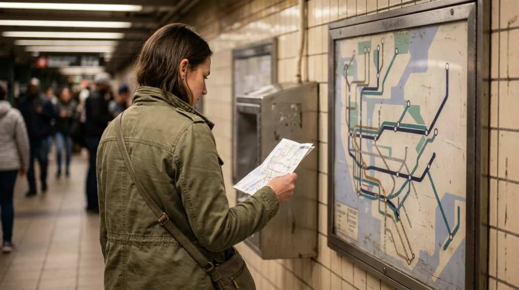
A subway map is a visual guide to train lines, stations, connections, and the routes available across a city’s underground or metro network. It helps you understand how to travel between places without needing to know every street.
For a woman traveling alone, learning the basic symbols before entering a busy station can reduce confusion and help her make decisions without rushing.
Understand the main map elements
Most subway maps use a few common elements, although the exact symbols differ between cities.
- Colored lines: These represent different train routes or services.
- Station names: These identify where trains stop along each route.
- Station dots: These mark stops, while special symbols may indicate transfer stations or accessibility features.
- Interchange symbols: These show where you can change from one line to another.
- Line numbers or letters: These identify the specific train service you need to board.
- Direction labels: These may name the final station, a neighborhood, or a compass direction.
- Map legend: This explains the colors, symbols, and abbreviations used on that particular map.
Never assume a color has the same meaning in every city. A red line in one network may have no relationship to a red line elsewhere.
Why subway maps don’t always match the streets
Many subway maps are schematic diagrams rather than accurate geographic drawings. Their main purpose is to show connections clearly, not to represent exact distances or street positions.
Two stations that look close together may require a lengthy underground walk, while a route that looks long on paper might be relatively quick by train.
Use a street map or walking directions when you need to find a station entrance, locate a nearby landmark, or walk between separate stations.
Know the difference between a station and a line
A station is the place where you board or leave a train. A line is the route the train follows between stations.
One station can serve multiple lines, which makes it useful for changing trains. However, stations with similar names aren’t necessarily connected, so always check the map’s transfer symbols.
Section Takeaway: Learn the map’s legend first, then identify station names, line labels, and transfer symbols. These basics make the rest of your journey much easier to follow.
How Can You Read a Subway Map Step by Step?
The easiest way to read a subway map is to plan one journey at a time. Start with your destination, find your current station, and trace the route before you enter the station.
Step 1: Find your starting station
Identify the station closest to your current location, hotel, or arrival point. If you’re standing outside, confirm the station name on a street sign or the official transit map.
Check the full name carefully. Large cities sometimes have stations with similar names in different neighborhoods, and choosing the wrong one can send you in the opposite direction.
Step 2: Locate your destination
Find the station nearest to the attraction, restaurant, museum, or accommodation you want to visit. If the place doesn’t appear on the subway map, search for the nearest station using a trip planner.
For example, if you’re visiting a museum, the closest station may not be the most convenient exit. You might need a short walk through surrounding streets after leaving the train.
Step 3: Trace the line between both stations
Look for a train line that serves both your starting station and destination. If one line connects them directly, you may not need to change trains.
If no direct route exists, follow the lines until you find a station where you can transfer to another service.
Step 4: Count your stops
Count the stations between your starting point and destination, excluding your starting station. This gives you a useful estimate of how many stops you’ll travel.
For instance, if your destination is four stops away, you can follow the station announcements or onboard display until you reach the correct stop. Remember that stop counts alone don’t tell you the journey’s exact duration.
Step 5: Confirm the train before boarding
Check the platform sign and the train’s destination display before you get on. Some lines operate in opposite directions from separate platforms, while others split into branches farther along the route.
Make sure the train serves your destination, particularly if the map shows express services, limited-stop trains, or different branches on the same line.
Step 6: Keep track during the journey
Once aboard, compare the station names on the map with the onboard display or announcements. You can follow the journey without constantly checking your phone.
If you miss your stop, don’t panic or try to jump off as the doors close. Get off at the next station, check the official route information, and plan your return or transfer.
A useful planning habit
Before leaving, write down three things: your boarding station, your destination station, and any transfer station. That small note gives you a simple reference if your phone battery runs low or the station becomes crowded.
Section Takeaway: Plan your route before boarding, verify the train’s destination, and monitor the station names as you travel. If you make a mistake, get off safely and reassess rather than rushing.
How Do You Identify Train Directions and Transfers?
Understanding train directions and transfer stations is essential when navigating an unfamiliar subway system alone. A correct route can still take you the wrong way if you board a train heading toward the opposite terminal.
Understand inbound, outbound, and terminal names
Subway systems use different methods to describe directions. Some use compass directions, such as northbound and southbound, while others use neighborhood names or the final station on the line.
Don’t assume that every city uses the same terminology. In Boston, for example, the MBTA uses inbound and outbound labels, with inbound service heading toward its designated central stations.
Before boarding, check these details:
- Final destination: Confirm the terminal shown on the train or platform sign.
- Travel direction: Match the destination with your intended direction of travel.
- Intermediate stops: Check whether your station appears on that service’s route.
- Branch information: Confirm that the train follows the correct branch if the line divides.
The official MBTA beginner’s subway guide explains local direction labels and other useful basics for Boston’s transit network.
What is a subway transfer?
A transfer is a change from one train line or service to another during the same journey. Your map may show a shared station, a connecting symbol, or two stations linked by a walking route.
Some transfers take place on the same platform, while others require stairs, escalators, passageways, or a walk outside the fare-controlled area.
Always check whether the map identifies the connection as a station transfer or a separate walking connection. Two stations with similar names may be several blocks apart.
How to follow a route with one transfer
Imagine you’re traveling from Station A to Station D, but no single line connects them directly.
- Take the Blue Line from Station A to Station B.
- Follow the interchange signs at Station B.
- Board the Green Line toward Station D.
- Follow the station announcements and exit at Station D.
This is an illustrative route, not a real journey in a particular city. On an actual trip, confirm that both services stop at your chosen interchange.
What if a subway line splits into different branches?
Some networks use one line designation for trains that travel along different branches. These services may share several stations before separating toward different destinations.
Check the final destination and intermediate stops rather than relying on the line’s color alone. If your destination appears only on one branch, board the service that follows that branch.
Section Takeaway: Match the train’s destination to your route and check every transfer before boarding. A line color helps you identify a service, but the destination sign confirms where that train is going.
Which Tools Make Subway Navigation Easier?
The best approach combines a clear subway map with current service information and a simple backup plan. You can use paper maps, official transit apps, and digital trip planners together without depending entirely on any one tool.
Paper maps versus digital maps
Both formats can help you navigate alone, but each has different strengths. Choose the format that you can read comfortably and access reliably during your journey.
| Feature | Paper map | Digital map or app |
|---|---|---|
| Best use | Understanding the overall network | Checking individual routes and service updates |
| Internet needed | No | Depends on the app and downloaded content |
| Live disruptions | Usually unavailable | Available when supported by the service |
| Route instructions | Requires manual route tracing | May provide step-by-step directions |
| Battery dependence | None | Requires a charged device |
| Finding street exits | Depends on map detail | Often easier with a street-level map |
For most solo trips, I recommend saving a digital route before leaving and keeping a screenshot or paper map as a backup. That way, you can still check your route if mobile data becomes unreliable.
Use the official transit app
An official transit app can help you check routes, arrivals, disruptions, and station accessibility. These features are especially useful when weekend engineering work or unexpected delays change your planned journey.
For example, the official MTA apps and travel tools provide New York City riders with transit information, including service updates and route-planning features.
Before traveling, learn how to:
- Enter your starting station and destination.
- Compare routes with different numbers of transfers.
- Check current service alerts and estimated arrival times.
- Find accessible stations and check elevator outages where relevant.
- Save your itinerary or download any available offline information.
Prepare a backup route
A backup route gives you another option if your chosen line is delayed, suspended, or unexpectedly crowded. You don’t need to memorize every alternative; simply identify one reasonable way to reach your destination.
Before departure, note the nearest alternative station, another available line, or a suitable bus connection. Confirm that the alternative is operating before changing your plans.
Also consider whether the alternative involves a long walk, an unfamiliar neighborhood, or an additional fare. A route with fewer transfers isn’t automatically the best option if it leaves you far from your destination.
Check accessibility before setting off
Subway maps sometimes mark stations with elevators, step-free access, or other accessibility features. However, the symbol alone may not tell you whether every platform and entrance is accessible today.
If you have luggage, an injury, or a mobility requirement, verify the station facilities and any elevator outages using the transit authority’s current information.
Section Takeaway: Use a map to understand the network and an official app to verify the journey. Save your route, check service updates, and identify a backup before you leave.
How Can a Woman Stay Safe While Navigating Alone?
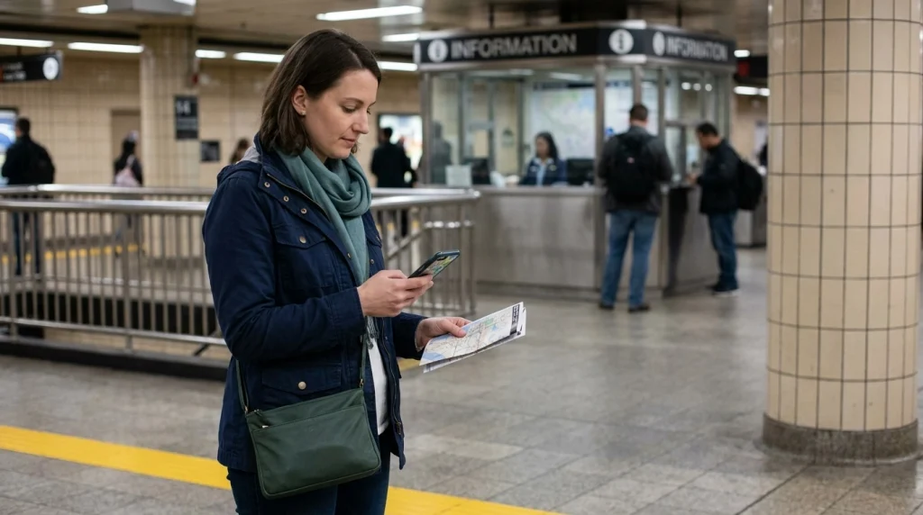
Reading a subway map safely means planning ahead so you can make decisions without feeling rushed. The goal isn’t to avoid public transportation; it’s to stay aware of your surroundings while knowing where you’re going.
Plan your route before entering the station
Large stations can be noisy and crowded, making it harder to read small labels or compare multiple routes. Decide on your main route and transfer points before you reach the ticket gates whenever possible.
Check the following details before leaving your accommodation:
- The name of your departure station and the entrance you’ll use.
- The train line and correct direction.
- Your destination station and expected number of stops.
- Any transfer station and the next line you need.
- Your return route and the service’s operating hours.
This preparation helps you move with purpose instead of repeatedly stopping in busy passageways to search for directions.
Keep your phone secure while checking the map
Your phone can be a useful navigation tool, but checking it near platform edges or in dense crowds can distract you from your surroundings.
When you need to check your route:
- Step away from platform edges and passenger flow.
- Stand near a wall or another suitable public area without blocking other travelers.
- Keep your bag closed and your phone firmly in your hand.
- Look up regularly to notice signs, exits, and approaching trains.
Download offline maps when available and carry a charged power bank if your trip depends on your phone. Keep a written note of essential station names in case your device becomes unavailable.
Choose your waiting spot thoughtfully
When waiting for a train, choose a well-lit, designated waiting area where you can see station signs and other passengers. Follow local platform markings and stay behind the safety line.
Where available, use staffed areas or marked help points if you need assistance. Avoid entering restricted areas or following someone through a gate simply because they appear familiar with the station.
What should you do if you feel uncomfortable?
If another passenger makes you uncomfortable, you don’t need to stay in the same carriage or explain your decision. Move toward a busier area, station staff, or an official help point when it is safe to do so.
If you believe you’re being followed, avoid going directly to your accommodation or another isolated location. Seek assistance from transit personnel or local authorities, and contact emergency services if you face immediate danger.
Keep your accommodation address and important contact details accessible without displaying them openly. Share your general itinerary with someone you trust if that helps you feel more prepared.
Check official safety and service information
Transit rules, emergency contacts, accessibility arrangements, and late-night services vary by city. Check the local transit authority’s official website for current guidance before traveling.
Pro tip: Review the official transit authority’s safety guidance and service alerts before your journey. For broader destination risks, consult your government’s current travel advisories and follow local emergency instructions.
Section Takeaway: Prepare before entering the station, protect your attention and belongings, and know where to find help. Confidence comes from having a plan and knowing how to adjust it safely.
What Subway Map Mistakes Should You Avoid?
Most subway navigation mistakes are manageable when you slow down and check the signs. Recognizing common problems in advance can help you avoid unnecessary transfers, missed stops, and confusing walks between stations.
Assuming line colors tell the whole story
A line’s color identifies a route on the map, but it doesn’t always tell you which branch a train will follow or whether it stops at your destination. Check the service label and final destination before boarding.
Confusing nearby station names
Some cities have several stations with similar names, or separate stations that serve different lines in the same neighborhood. Read the complete station name and verify whether a walking transfer is required.
Forgetting about express and local services
Express trains may skip stations served by local trains. If your destination is a smaller station, check whether the service you plan to board actually stops there.
Assuming the map shows live conditions
A printed map usually shows the network rather than real-time operating conditions. Temporary closures, delayed trains, and maintenance work may require a different route.
Check official alerts close to departure, especially for late-night journeys and trips involving several transfers.
Ignoring station exits
A large station may have multiple exits leading to different streets, attractions, or sides of a busy road. Before leaving the platform, check which exit brings you closest to your intended destination.
If your map doesn’t identify exits, use the station’s exit signs and confirm the walking route on a street map after reaching a safe public area.
Rushing when you make a mistake
Missing a train or boarding the wrong direction can happen to anyone. Stay calm, follow station rules, and use official signs or staff guidance to correct your route.
Never run onto a platform to catch a departing train or cross a track to reach another platform. The extra few minutes required to correct your route are worth the safer decision.
Section Takeaway: Check complete station names, train destinations, service patterns, and exits. When something doesn’t match your plan, pause in a safe place and verify your next step.
Frequently Asked Questions About Reading Subway Maps Alone
How can I read a subway map if I’ve never used one before?
Start by finding your current station and destination, then follow the line connecting them. If you need to change trains, identify the interchange and the next line. Confirm the train’s destination before boarding and follow station announcements during the journey.
Should I memorize the subway map before traveling alone?
No, you don’t need to memorize an entire subway network. Learn your planned route, key transfer stations, and return journey instead. Saving a map or route screenshot gives you a quick reference without requiring you to remember every station.
How do I know which direction a subway train is going?
Check the train’s final destination, platform signs, and any direction labels shown on the map. Depending on the city, directions may use compass points, neighborhood names, or terminal stations. Verify that your destination appears on the train’s route before boarding.
What should I do if I get on the wrong subway train?
Stay calm and get off at the next appropriate station. Check the official map or trip planner to determine whether you should cross to the opposite platform, take a connecting train, or return along your route. Never cross tracks or enter restricted areas to correct a mistake.
Can I use a subway map without internet access?
Yes. A printed map, saved screenshot, or downloaded offline map can help you identify stations and plan a route without mobile data. However, you may not receive live service alerts or arrival information, so check operating conditions before departure whenever possible.
Is it safe for a woman to travel alone on the subway at night?
Safety depends on the city, route, time, current conditions, and individual circumstances. Check local travel advice and transit operating information, stay aware of your surroundings, and know how to contact staff or emergency services. If a route feels unsuitable, consider another available transport option.
What is the easiest way to avoid getting lost in a large subway station?
Identify your line, direction, and transfer station before entering the station. Follow official signs rather than relying only on memory, and confirm the correct exit when you arrive. If you become confused, ask transit staff for directions in a designated public area.
Final Takeaway: Travel With a Simple Subway Plan
Learning how to read a subway map is a practical skill that can make solo travel less stressful and give you more freedom to explore unfamiliar cities.
Start with one journey, identify your stations, trace the correct line, and confirm the train’s direction. Then check service alerts and save a backup route before setting off.
You don’t need to know every station or understand an entire transit network on your first day. Take each step as it comes, give yourself time to check signs, and ask official transit personnel for help whenever necessary.
The more you practice, the easier subway navigation becomes. With a little preparation, you can spend less time worrying about the map and more time enjoying your solo adventure.